Dominica's interior is spectacular. Small family farms are scattered throughout the mountains, but most of the island is a series of vertically stacked, unique ecosystems. Several hundred feet of elevation change has a large effect on temperature, moisture, plant and animal life. The west side of the island is drier and more protected than the east. The 9 active volcanic peaks are typically in clouds. Morne Diablotins is 4717 feet high - the 2nd highest peak in the Lesser Antilles. The opportunities for ecotourism are great, and the islanders understand this. Poverty, disorganization, and transportation often stand in the way.
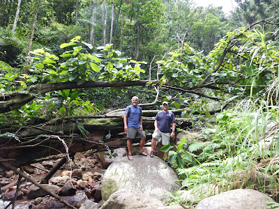 |
| Hike to Milton Falls, privately owned by a farmer |
 |
| Milton Falls |
 |
| Commandant's Quarter, Fort Shirley Ruins |
The northwestern corner of the island, Prince Rupert's Bay, was historically the first stop for vessels sailing from Europe in the 18th century. There was plenty of fresh water and provisions, and ships could resupply after an Atlantic crossing. Since these sailors could not calculate their longitude accurately, they would simply sail west along 16 degrees north. Starting from the Canary Islands, off of northern Africa, boats would arrive between Guadeloupe and Dominica as they reached the Caribbean. Columbus did this repeatedly. The 1608 Jamestown settlers used this route and stopped at Fort Shirley, just a couple hundred yards from where we are anchored. As the trade route was established, Caribbean pirates often lay waiting to plunder. Fittingly, several scenes from the Pirates of the Caribbean were filmed here. It is amazing to us that Dominica remains a 3rd world country. Difficult to understand, but this screen grab from Wikipedia is part of that story.
Hurricanes in Dominica
 |
| Portsmouth Saturday Market |
 |
| Cocoa Plant |
 |
| Tree Ferns |
 |
| Small family farm growing dasheen, a tuber |


Comments
Post a Comment