Day 1: West River, MD to Chesapeake City, DE.
Position: Home Slip - 38*50.22 N, 076*32.51W to Chesapeake City, MD 39*31.68N, 075*51.68W
NM: 57.47 motor sailing
Sea State: wind - 5-10 SE decreasing, 2-3 ft waves
Thursday night at our home marina: didn't get much sleep...nerves, anticipation, unknowns. Kelly and Chris seemed to sleep OK and that was reassuring to me. Kelly seemed confident that we had covered all the critical needs, and we just need to go.
Left the West River at 5:30 AM under power, nav lights on, radar running. A few crabbers were out checking their pots, but otherwise it was dark and quite. We knew the wind was coming up the bay from the south and this pattern creates some of the largest waves on the Chesapeake. The wind has a long fetch and this allows the ways to develop. The choppy, step waves are our least favorite. We once made the mistake of taking the Pattons out when it was blowing from the South, it's been hard to convince them to come again. Kelly heads out to the green can (G1) and we take the waves on the beam until Iolair rounds Thomas Point Light House.
Rollie, rollie boat... The boat rocks too much...so much that Chris has to bail out of the forward cabin and come into the cockpit. He looked a bit green, and I thought "here we are 4 miles from home and we are already screwed." But we've been here before, and as soon as we turn North we have a following sea. Kelly matches the boat speed to the waves and Iolair settles into a very peaceful rhythm. Now it is easy to go below and cook breakfast. The waves break easily on the stern and the boat gently surfs the troughs. What a huge difference 90 degrees can make. Everyone feels better and we are headed north.
Past a couple of anchored tankers. I think they were put there just to remind us off what we'd be encountering over the next couple of days. Under the Bay Bridge at sunrise.
North past Lover's Point and into unfamiliar waters. No targets on the AIS, but radar is showing a few power boats around. One specially large one off the starboard bow, that looks kind of like a little navy destroyer. The Navy ship is set up to act like a warship, and the cadets move past our bow and steam up the Bay. Radio silence, no AIS...maybe we were their pretend enemy target. We cross the large shipping channels that head into Baltimore, with no vessels in sight.
 The wind decreases as we move up the bay, so we happily motored along. We could have flown the spinnaker but with cargo ships, navigation, and sleep on our minds we chose the stinkpot approach. Kept the radar on all day, so we could practice and compare what our eyes were seeing with the way the radar sees things. Basically the radar shows you outlines of the coast line and bridges. It can't tell you what is behind something. The metal navigation aides look like little boats, the larger blips moving at faster speeds...look for a bigger boat.
Not everyone has AIS, and the old radar quickly became an important tool to help us understand what was going on around the boat. I can only imagine how useful the newer digital ones must be....add that to the wish list.
The northern bay is beautiful. Kelly and I both want to return to the Sassafras River for a longer stay.
We settled in behind another northbound boat, and before we knew it we entered the Chesapeake-Delaware Bay. The tide was flooding, and it added 1.5 knots to our boat speed. Speed over ground was 8.4 knots.
 1:30 PM: The entrance into the little anchorage on the canal at Chesapeake City was shallow, but we never saw less than 9 ft - Iolair draws 6.7 ft. The anchorage only had a couple of boats in it.
First Day done, and it was definitely time for a nap.
NM: 57.47 motor sailing
Sea State: wind - 5-10 SE decreasing, 2-3 ft waves
Thursday night at our home marina: didn't get much sleep...nerves, anticipation, unknowns. Kelly and Chris seemed to sleep OK and that was reassuring to me. Kelly seemed confident that we had covered all the critical needs, and we just need to go.
Left the West River at 5:30 AM under power, nav lights on, radar running. A few crabbers were out checking their pots, but otherwise it was dark and quite. We knew the wind was coming up the bay from the south and this pattern creates some of the largest waves on the Chesapeake. The wind has a long fetch and this allows the ways to develop. The choppy, step waves are our least favorite. We once made the mistake of taking the Pattons out when it was blowing from the South, it's been hard to convince them to come again. Kelly heads out to the green can (G1) and we take the waves on the beam until Iolair rounds Thomas Point Light House.
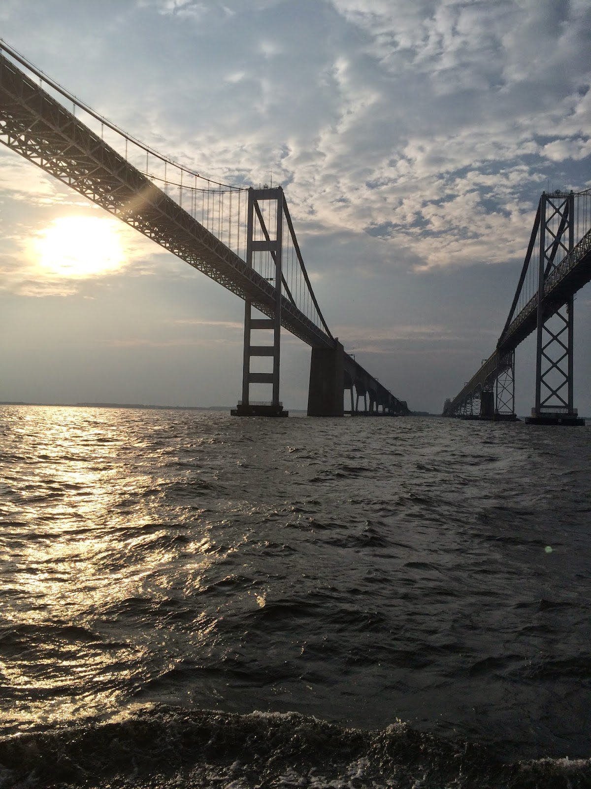 |
| Chesapeake Bay Bridge, photo by CP |
Rollie, rollie boat... The boat rocks too much...so much that Chris has to bail out of the forward cabin and come into the cockpit. He looked a bit green, and I thought "here we are 4 miles from home and we are already screwed." But we've been here before, and as soon as we turn North we have a following sea. Kelly matches the boat speed to the waves and Iolair settles into a very peaceful rhythm. Now it is easy to go below and cook breakfast. The waves break easily on the stern and the boat gently surfs the troughs. What a huge difference 90 degrees can make. Everyone feels better and we are headed north.
Past a couple of anchored tankers. I think they were put there just to remind us off what we'd be encountering over the next couple of days. Under the Bay Bridge at sunrise.
North past Lover's Point and into unfamiliar waters. No targets on the AIS, but radar is showing a few power boats around. One specially large one off the starboard bow, that looks kind of like a little navy destroyer. The Navy ship is set up to act like a warship, and the cadets move past our bow and steam up the Bay. Radio silence, no AIS...maybe we were their pretend enemy target. We cross the large shipping channels that head into Baltimore, with no vessels in sight.
Not everyone has AIS, and the old radar quickly became an important tool to help us understand what was going on around the boat. I can only imagine how useful the newer digital ones must be....add that to the wish list.
The northern bay is beautiful. Kelly and I both want to return to the Sassafras River for a longer stay.
We settled in behind another northbound boat, and before we knew it we entered the Chesapeake-Delaware Bay. The tide was flooding, and it added 1.5 knots to our boat speed. Speed over ground was 8.4 knots.
First Day done, and it was definitely time for a nap.


Comments
Post a Comment